Sunday 23 February 2020

Thwaites Science

Erin dragging the GPR across the ice shelf. 
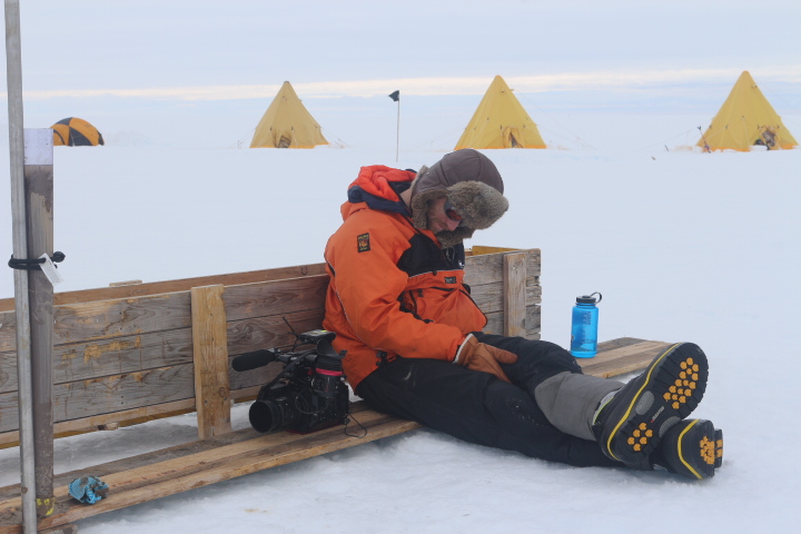
Having written about my experiences working on Thwaites Glacier in my previous blog post, I thought that it would be insightful to write a bit about the research which was carried out. This, after all, was the reason we were there.
Myself and Christian enjoying a brew at a ApRes site.
Thwaites Glacier is one of the most rapidly changing areas in Antarctica, and these changes have the potential to significantly contribute to sea level rise. The Thwaites Glacier drains a huge area (roughly the size of Britain). The land surface below much of this drainage basin (and West Antarctica in general) is below sea level. If the sea was able to infiltrate under the ice, it could lead to a significant destabilisation of the ice sheet, which would lead to significant sea level rise. For this reason the area has been described as the soft underbelly of West Antarctica.
Digging in Geophones for Atsu's seismic work. He can just be seen at the end of this line of geophones about 400m away. 
The Thwaites project is a multi-year collaborative project which attempts to understand the changes that are occurring in the area, and what the future might hold for it. This season there were a number of science teams working on and around the Thwaites Glacier. I was working with the TARSAN team. The acronym TARSAN stands for Thwaites-Amundsen Regional Survey and Network Integrating Atmosphere-Ice-Ocean Processes. There were two aspect to TARSAN, one being ship based, and one other being ice based. I was to be part of the latter which was based on a small ice shelf around 20km across called the East Thwaites Ice Shelf. It is held in place by being grounded on undersea rise. It is however, starting to show signs of instability.

Another benefit of drilling through the ice sheet,
you can dry your sock on the water heater. 
The project got some attention from the media. There was a team from the BBC at another field camp (MELT) who were based about 30km away from ourselves. Their report does a pretty good job of explaining the purpose of the work  https://www.bbc.co.uk/news/science-environment-51097309.   More information about the project in general and the specific teams can be found at  https://thwaitesglacier.org/.

There were two aspects to the science that TARSAN carried out; geophysics and the  drilling/AMIGO. A variety of geophysical techniques were used to collect data on ice shelf properties over as much of the ice shelf as it was deemed safe to travel.
A 300 metre hole through the ice sheet. 
One method was ApRes. This  uses radar to accurately measure ice thickness at specific locations. This was done for grid of around forty locations. By marking these locations with flags, and then repeating the measurements at least a week later, the ice thinning/melting rates could be calculated. Repeat GPS measurements of these points was also carried out to measure the velocity of the ice shelf. The whole ice shelf was moving at around two meters per day.

Ground Penetrating Radar (GPR) involved dragging a radar device along at a very steady speed to create a profile of ice thickness and properties. A number of different frequencies were used, in general the lower the frequency the deeper into the ice the radar looked.  This was done on foot by one individual who dragged the radar a total of about 270km during the her time out in the field. It was found that the underside of the ice shelf was anything but flat with some interesting steps in ice thickness.
The final geophysics method used was active seismics. This involved digging long lines of geophones into the snow, and then detonating small buried explosive charge at the end of the geophone line. The geophones would record the echo of the explosion as it bounced of the base of the ice and the of the sea floor. From this the thickness of the ice and the depth of the ocean below can be calculated.
Raising the AMIGO tower. Photo Karen Alley.
The other major aspect of the project was the drilling/AMIGO. This involved drilling a couple of holes in the ice shelf. At the location of the first hole the ice was about 300m thick, at the second hole it was around 250 meters. After the holes were drilled instruments were lowered down to measure ocean salinity, temperature and acoustics, and samples of the ocean bed were taken. After this other instruments were installed to monitor temperature throughout the ice and ocean, and to record data about the ocean currents. A tower called an AMIGO was then erected. This would monitor weather conditions at the site, and transmit this and the ocean data back to the science teams over the next few years. The aim is to return in a few years to collect dig out and remove the AMIGOs.

The AMIGO tower with the camp in the background. 


Tuesday 4 February 2020

Hurry up and Thwaite!


The LC130 at Waste Divide. 
Luxury travel in the LC130
I recently returned to McMurdo after about six weeks out on the Eastern Thwaites Glacier Ice Tongue. It has been very much a season of long delays interspersed with very busy periods, or if like a terrible pun, hurry up and Thwaite.

I was working as a field guide for the British Antarctic survey (BAS) with a mainly American team as part of the International Thwaites Glacier Collaboration (ITGC). The ITGC is a collaboration mainly between the British and the Americans to study the Thwaites Glacier area of West Antarctica. There were a number of field teams at different locations around the glacier studying the rapid changed that have occurred in the are in recent years. In this post I will focus on the season in general, and discuss the science that was carried out in a future blog post.   

The delays this season have focused around getting in and out of  McMudro. In my previous post, written in late November, I mentioned the delays we had experienced in getting to McMurdo, and then in leaving McMurdo. Well the latter continued after I had written the post. After a couple of false starts I didn’t actually leave McMurdo until the 13th of December when I was flown on a LC130 to Waste Divide.  Waste Divide is a major logistics hub for USAP operations in West Antarctica and is situated at about 79°S. It plays a similar role for USAP that Sky Blu does for BAS (a place I spent a lot of time back in 2015/16 and wrote about here http://blairfyffe.blogspot.com/2015/12/sky-blu.html), but being USAP is much more substantial.

Arriving at the site that would become Cavity Camp via Basler. 
Fortunately the four skidoos and a lot of the science kit our team required had overwintered at Waste Divide and had already been flown down to our field site while we had remained stuck in McMurdo. This meant that once we arrived at Waste Divide things moved pretty quickly. I was only on the ground at Waste for a few hours before myself and two other members of the team climbed aboard a Basler and headed off. We were flown down to a spot on the Eastern Thwaites Ice Tongue that we called Cavity Camp, and would be our home for the next few weeks.

Cavity Camp from the air about ten days after it had been established.  
There were three of us on first put in flight to Cavity Camp, and three more people arrived the next day. However, due to further weather delays it was another week or so before all eleven members of the team had arrived. The team consisted of eight scientist/technicians, two field guides and one journalist. The aim was to carry out various geophysical surveys of the area, and to drill a couple of holes through the iceshelf. 

Wetness on the side of the tent. It was not
cold where we were with some
very wet snow/rain.
Initially myself and Cece, the other field guide, spent our time out proving the routes required for the geophysics. In the planning process a lot of effort had been put into studying satellite images and choosing safe working areas. Initially we were quite cautious of buried crevasses. However, in the end the area proved to be quite benign, with no surface crevassing being observed.  After a few weeks of proving routes and carrying out geophysical surveys, on the 30th of December the drilling started.
The full team in front on a trusty twin otter. 
It could get quite busy with eleven people in our cook/dinning tent. 
The purpose of the drilling was to put a hole through the ice shelf into the ocean below so as to make various measurements and install monitoring equipment. We ended up working on it for 36 hours straight.  For this period we were joined by another scientist and a BBC camera man working on the Frozen Planet II. 
Accommodation was in a mix of mountain tents (in picture) and more traditional pyramid tents. This gave everyone their own space, but did require a bit of effort to maintain including building some substantial wind walls. 
Given the success of the drilling and geophysics it was decided that in early January that half the team would head over to another ice shelf (the Dotson) to do some geophysics work there, and the other half would remain on the Eastern Thwaites ice tongue to drill a 2nd hole a few kilometers away from the first. I would stay with the drillers.
The Doston team headed off on the 8th of January, and after a few days of moving camp and equipment four kilometres we were ready to start drilling the second hole. Although we only had six rather than thirteen people, the ice was a little thinner in this location (about 250 metres), there was not geophysics happening concurrently and we knew better what we were doing. This meant the drilling went a lot more efficiently with the whole process being successfully completed in 24 instead of 36 hours. After that a few days of packing up equipment and tents, and we was flown back to Waste Divide by twin otter on the 18th of January, and then on to McMurdo a few days later. I had been out on the Eastern Thwaites Ice Tongue for 35 nights.
The first drill hole was done in a 36 hour push. This led to some tired people. Ben the cameraman from Frozen Planet II having a wee snooze (it was about 5am at this point) while waiting from an instrument to come up. A core sample form the sea bed can be seen in the tube to the left. 
Overall the weather we experienced out at Thwaites was better than expected with only few days of science being lost to weather. It was generally pretty warm for Antarctic standards with the temperature generally between about minus three and plus two degrees Celsius. The was a couple of days of wet snow verging on rain in mid December. Although unpleasant at the time, the advantage of this was when the weather cleared and the temperature dropped, the snow surface hardened up to give a good firm surface which was easy to travel on. We did have one storm during our time out here. In terms of pure wind strength it was not that high, only around 30 knots. However, it did occur after a snow fall so there was a significant amount of drifting, and thus a fair bit of digging was required to maintain camp.  We also unfortunately manged to rip a large hole in the side of the main cook tent during this storm which we did manage to fix but required some hardcore storm sewing.
Sewing up the tent after it was ripped in the storm.

I type this sitting in McMurdo.  I was suppose to be leaving McMurdo a few days ago, but unfortunately the American Air Force C17 which was suppose to take us off continent seemed develop a problem with an engine when it landed, and thus could not transport us.  In total three of the four flight I have had in/out of mcMurdo has been significantly delayed by weather/planes breaking down. Looks like another day of hurry up and Thwaite!

A C17 with a broken engine leading to more delays. Notice the ladder below the rightmost engine. Seems to be a common theme!