Friday 18 December 2020

Some More Snow Ponderings

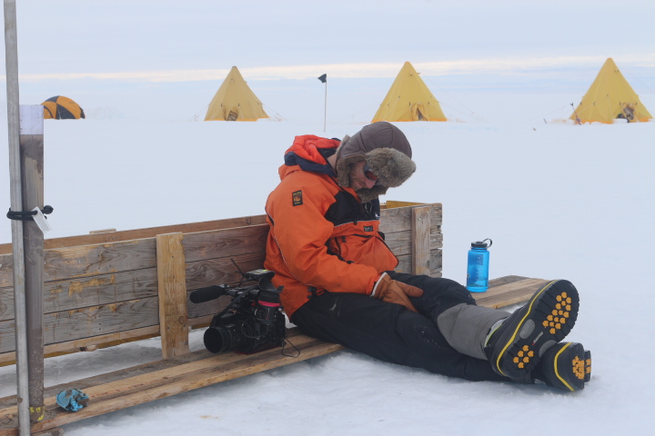
Exploring the snow tunnels on Ben Nevis during August. 

After neglecting my blog for the last eight months or so I feel inspired to get back to it. During lockdown I didn't feel inspired to write and more recently, despite not really working and thus having a fair bit of time, the inertia required to get writing again has prevented me from getting going. However, now that I have got going, I hope to update things a bit more regularly. I thought that the easiest subject to start with would be one I have written a fair bit about before, snow. 

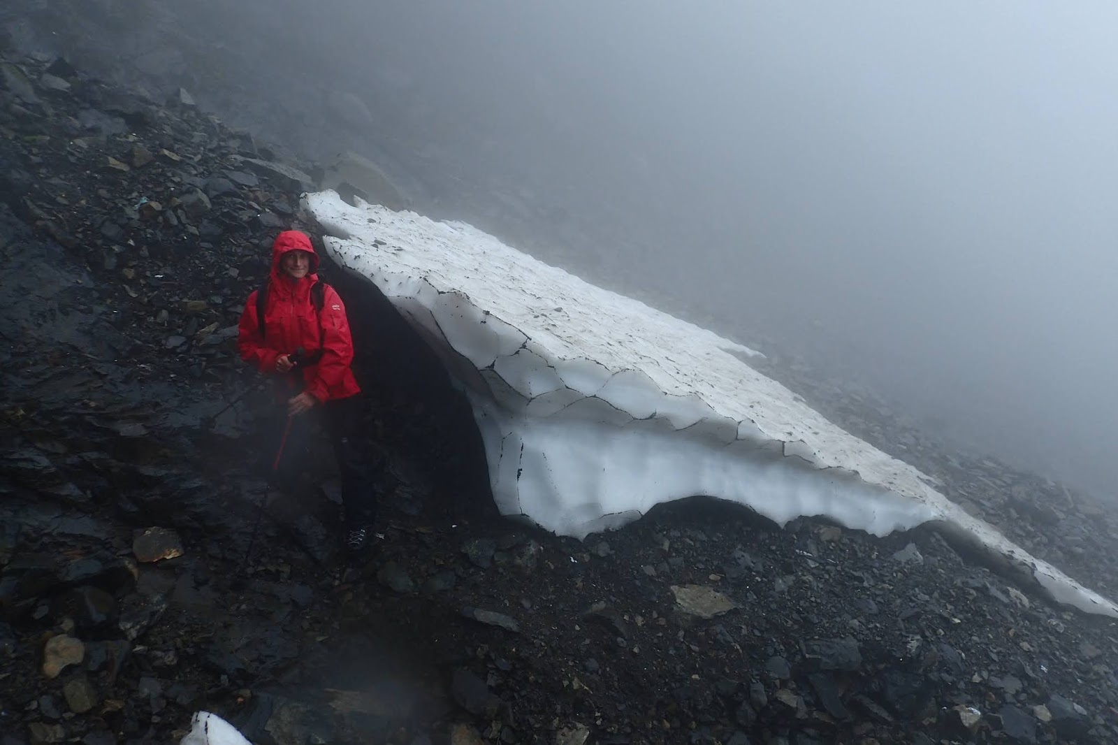
An impressive snow tunnel at the Point 5 Patch. 
Last spring the amount of snow on the Lochaber hills was greatest in mid to late March, just around the time that lockdown started. Although I don't have any hard data on this, I am sure this is earlier than is typical, normally snow amounts peak in April or May. The main reason for is that April was unusually dry and sunny, a fact that would not have gone unnoticed to everybody stuck in lockdown. Although there was no snow added to the snow patch locations during this period, there also would have been little melting in the high shady locations where the snow patches lie. 

As usual the majority of the melt occurred from late spring/early summer until early Autumn. Melt rate is controlled not just by temperature, but by a combination of this and rainfall, with both high temperatures and rainfall leading to increased melt. This the summer was average in terms of both temperature and rainfall, and thus likely to be pretty typical in terms of snowpatch melting. I noticed that Scott of Wanstead Meteo blog visited Ben Nevis in the summer to have a look at the snow patches, and recently wrote a nice analysis of the summer melt season (which he found to be around average) and can be found here; https://wansteadmeteo.com/2020/11/05/cathedrals-of-snow/

The depth of snow in the Observatory Gully patch in mid/late August. 

Every year there is an annual snowpatch survey occurs on or around the 20th of August, and as is often the case I headed up Ben Nevis with a few few friends to have a look around. Although it was the not snowiest I had seen the Ben at that time of year, it was not at all bad with things looking positive for a few survivals. There were certainly some impressive snow tunnels to have a look at. 

The Met Office mean temperature for the uk during the Autumn. Although not specific to the area, it is still useful to show the warm and cold periods. 

After an average to mild start to September, the first hints of Autumn arrived on the 22nd of September. The first proper snows fell about three weeks later on the 9th or 10th of October. Although there was some reasonable drifts at the tops of some of the gullies (and is seems likely some of these drifts were the lasting snow in these locations), little fresh snow made it down to the locations of the snowpatches, and any that did soon melted. The middle of the month was cool and dry which slowed melting. There was a dusting of fresh on the 23rd of the month, and then a bit more on the 29th/30th, with further falls on the 3rd and 4th of November. The middle of November was mild and wet, before more substantial fresh snow arriving on the 21st, after which is stayed cold with further snow falls. 

In Lochaber this year five snowpatches survived; two on Aonach Mor, two on Ben Nevis and one on Aonach Beag. It is about 5 years since we have had so many survivals in Lochaber. 

Coire an Lochan of Aonach Mor on the 11th of October. The two patches of last years snow are visible below the crags. Notice how with just a small dusting of snow it has built up significantly around the coire rim. 

Some years it is very clear when the lasting snow arrives at the snow patches, there is a substantial snowfall one day in October or November, and then it stays cold with additional snow until the patches are clearly buried. Other years it is a bit more subtle, with the fresh snow coming and going. It can be hard to tell whether a particular fall of fresh snow melted or not, and thus working out when the lasting snow arrived can be tricky. I think this year is a tricky one, with the date of the lasting snow (at least in my opinion) being different for the Ben Nevis and the Aonach Mor snow patches. 

The two patches that survived on Aonach Mor are both found in Coire an Lochan and are called Piranha and Pro-talus, the names referring in the first case to the climb is it situated under, and in the second, the feature that it sits in. Aonach Mor is made of granite which, due to it's chemistry, tends to have more vegetation than the rhyolite of Ben Nevis. The summit plateau of Aonach Mor is fairly flat and smooth, and ledges slopes of the the coire tend to be grassy and smooth. The smoothness of the plateau means that even during the first snow falls of the season, there is little to prevent the snow blowing along the ground and accumulating at the top of Coire an Lochan. Once there it does not take much  build up before the snow can sluff and avalanche downwards towards the snow patches which sit near the base of the crags.  

The Pro-Talus patch on Aonach Mor on the 26th of Nov. Although the old snow in visible in the middle ground, the far side of the patch (where the rucsac is) was well buried by avalanche debris. 

Avalanche debris was observed lying on around and on top of the two Coire an Lochan snowpatches on the 31st of October. A picture from the 10th of November shows additional avalanche debris surrounding the patches, and filling in the gaps at the side. It was warm and wet for the next week or so, and with no observations it is difficult to tell how much of this debris survived. My feeling is that some of it, particularity where it was packed around the snowpatches did survive. I would say therefore that the two patches on Aonach Mor the lasting snow arrived in late October, either the dusting on the 23rd or the more substantial fall during the night of the 29th. 

The Observatory Gully Patch on the 30th of October. There was a uniform layer of fresh snow while at this time the patches on Aonach Mor were buried by avalanche debris. 

The terrain on Ben Nevis is a bit different to that on Aonach Mor. The summit plateau is a boulder field, the crags themselves are rougher and the snow patches are in locations a bit more removed from the top of the crags. During any early season snowfall, a lot of the snow gets stuck between the boulders, and much more build up is required for avalanches to move the snow down to the snowpatch locations than is required in Aonach Beag. I headed up for a look on the 30th of Oct, the same days that the Coire an Lochan patches were covered in avalanche debris. Two patches that survived on Ben Nevis this year.  These are the Point Five patch and the Observatory Gully patch, both named after the gullies they lie in/at the base off. There was very little fresh snow at the former, and at the latter uniform covering of  around 15cm of fresh snow with little evidence of drifting or avalanche debris. This fresh stuff could not withstand the mild wet conditions of mid November, and when these patches were visited no fresh snow was observed on a visit to this location by a colleague on the 18th. On the 21st of November there was a dusting of fresh snow on the hill, and this continued to be added to over the few days. It soon became clear that the lasting snow had arrived here as well. 

Friday 27 March 2020

Plenty of snow for 2020.

For the past few years I have written a post about the amount of snow on the Scottish hills, usually some time during April. Although not quite there yet, I thought given current events and perhaps the lack of opportunity to return to the hills for a while, I thought it would be a good time to write a piece about this winter's snow cover.

However, before discussing this season, I thought I would have a look back at what I wrote last year, which can be found here https://blairfyffe.blogspot.com/2019/03/snow-patch-predictions-2019.html, and compare with what actually occurred. I had said  "I think it would take a combination of an unusually cold snowy spring followed by a cool dry summer for any snowpatches to survive through to next winter. I don't think it is likely they will survive this year, but am hoping to be proved wrong about that." Well, I was proved wrong, but only just, as one tiny remnant of the the Sphinx patch over in the Cairngorms did survive to be buried by this winter snow fall.

Ben Nevis on the 7th of February 2020. Not looking particularly snowy. 
I am glad to say that this year the things are looking a lot more positive than they did this time last year. Due being in Antarctica working on the Thwaites project this year (see my previous blog posts), I missed the beginning of the winter. However, it was generally mild, stormy and wet, and I don't seem to missed much in terms of winter conditions during December and January.

I finally made it back to the UK on the 9th of February, just in time for my train from London to the Highlands to to be cancelled due to Storm Ciara. Snow cover at that time was pretty poor for the beginning of February, and it was looking like could be another lean year for the snow patches. However, Storm Ciara, Storm Dennis and the following few weeks of unsettled weather dumped a lot of precipitation on the West of Scotland. The Met Office West of Scotland rainfall total for the month of February was 339.8mm, which is 237% of the 1980-2010 average. Interesting despite rainfall being over double average the, sunshine was not too far of average with 59.4 hours; 92% of the mean value.
Coire an Lochan on the 20th of March 2020. Loads of snow!
 Although not particularly cold, it was cold enough for the majority of this precipitation to fall as snow on the hills. With the winds being consistently between the South and the West, the North and East facing coires and hollows where the long lying snowpatches lie really filled in well. Weather wise March started off on a similar note before settling down around the middle of the month. By then there was a great deal of snow on the hills.

In the past I have posted a series of images of the South side of Coire Lochan of Aonach Mor, see the link near the beginning of this post. These pictures are generally taken in April rather than March. However, with but with the long range forecast being relatively cool and dry the snow quantity is unlikely to be significantly different in early April that that shown in the picture above.

To summarise the results of a comparison with other years, there is more snow now in Coire an Lochan any other year since at least 2005 with the exception of 2013/14. Below is a photo from March 2014, what do you think? I don't think there is much in it in terms on snow quantity.
A picture from the March 2014. I would say generally pretty similar in terms of snow quantity to March 2020.  
Over on nearby Ben Nevis most years a patch survives in Observatory Gully, the large bowl/gully in the centre of the pictures below. The locations of this patch is about two thirds the way up the gully, just below where it narrows significantly. Comparing the two pictures below, one from the 22nd of March 2020 and the other from March 2014, it looks like this area of Ben Nevis had a more snow during 2014. However, there are other areas of Ben Nevis where the amount on snow looks very similar.
Ben Nevis on the 22nd of March. A lot of snow, although not quite as much as 2014.  I would say that the Observatory Gully patch is very likely to survive the summer, and that the Point Five patch, which is also visible in this shot, has a fair chance.
Ben Nevis in March 2014. Loads of snow in the Lochaber hills that year, which led to a good number of survivals. 
This post has focused of the hills around Lochaber as that is where I am based. I have not been over to the Cairngorms for a while, but the likes of this post by Iain Cameron  https://twitter.com/theiaincameron/status/1242017454362169344?s=20 suggests things are looking pretty snowy over there was well.

So what does this mean in terms of snowpatch survivals? The first of the two main factors that affect this is how much snow there is at the end of the winter, which this year there is a lot of. The second is what happens weather wise through the spring, summer and autumn, and this can also have a significant effect. Although less snow fell in the winter of 2014/15 as compared  to 2013/14,  more snow patches survived during the summer of 2015 than 2014. This was mainly due to a cold and snowy April and May (I went ski touring that year in early June). On the other hand although the winter of 2017/18 was a reasonable one in terms of snow fall, but only one patch survived the long hot summer that followed.

So in summary, it is a promising start,  and that with the the exception of the winter of 2013/14 there is more snow on the Lochaber hills than any time in the past fifteen or so years. I would say it is very likely that snow will survive on Ben Nevis and Aonach Beag this year. As for the fate of more marginal patches like the one found in Coire an Lochan of Aonach Mor, this will depend very much on what the weather does for the next seven months or so.

Coire an Lochan March 2020. Notice how the edge is roughly straight between where I took the picture and the figure as compared to summer where the edge really cuts in. 
Coire an Lochan in summer. The longest lying snow sits on the rocky slab reflecting the sunlight. 
The top of Easy Gully. Notice there is very little sign of the rocky rib on the right.  
The top of Easy Gully in the summer time. The fact that the rocky rib which is so obvious here is almost gone at the moment gives an idea of how much snow there is here at the moment. 


Sunday 23 February 2020

Thwaites Science

Erin dragging the GPR across the ice shelf. 
Having written about my experiences working on Thwaites Glacier in my previous blog post, I thought that it would be insightful to write a bit about the research which was carried out. This, after all, was the reason we were there.
Myself and Christian enjoying a brew at a ApRes site.
Thwaites Glacier is one of the most rapidly changing areas in Antarctica, and these changes have the potential to significantly contribute to sea level rise. The Thwaites Glacier drains a huge area (roughly the size of Britain). The land surface below much of this drainage basin (and West Antarctica in general) is below sea level. If the sea was able to infiltrate under the ice, it could lead to a significant destabilisation of the ice sheet, which would lead to significant sea level rise. For this reason the area has been described as the soft underbelly of West Antarctica.
Digging in Geophones for Atsu's seismic work. He can just be seen at the end of this line of geophones about 400m away. 
The Thwaites project is a multi-year collaborative project which attempts to understand the changes that are occurring in the area, and what the future might hold for it. This season there were a number of science teams working on and around the Thwaites Glacier. I was working with the TARSAN team. The acronym TARSAN stands for Thwaites-Amundsen Regional Survey and Network Integrating Atmosphere-Ice-Ocean Processes. There were two aspect to TARSAN, one being ship based, and one other being ice based. I was to be part of the latter which was based on a small ice shelf around 20km across called the East Thwaites Ice Shelf. It is held in place by being grounded on undersea rise. It is however, starting to show signs of instability.

Another benefit of drilling through the ice sheet,
you can dry your sock on the water heater. 
The project got some attention from the media. There was a team from the BBC at another field camp (MELT) who were based about 30km away from ourselves. Their report does a pretty good job of explaining the purpose of the work  https://www.bbc.co.uk/news/science-environment-51097309.   More information about the project in general and the specific teams can be found at  https://thwaitesglacier.org/.

There were two aspects to the science that TARSAN carried out; geophysics and the  drilling/AMIGO. A variety of geophysical techniques were used to collect data on ice shelf properties over as much of the ice shelf as it was deemed safe to travel.
A 300 metre hole through the ice sheet. 
One method was ApRes. This  uses radar to accurately measure ice thickness at specific locations. This was done for grid of around forty locations. By marking these locations with flags, and then repeating the measurements at least a week later, the ice thinning/melting rates could be calculated. Repeat GPS measurements of these points was also carried out to measure the velocity of the ice shelf. The whole ice shelf was moving at around two meters per day.

Ground Penetrating Radar (GPR) involved dragging a radar device along at a very steady speed to create a profile of ice thickness and properties. A number of different frequencies were used, in general the lower the frequency the deeper into the ice the radar looked.  This was done on foot by one individual who dragged the radar a total of about 270km during the her time out in the field. It was found that the underside of the ice shelf was anything but flat with some interesting steps in ice thickness.
The final geophysics method used was active seismics. This involved digging long lines of geophones into the snow, and then detonating small buried explosive charge at the end of the geophone line. The geophones would record the echo of the explosion as it bounced of the base of the ice and the of the sea floor. From this the thickness of the ice and the depth of the ocean below can be calculated.
Raising the AMIGO tower. Photo Karen Alley.
The other major aspect of the project was the drilling/AMIGO. This involved drilling a couple of holes in the ice shelf. At the location of the first hole the ice was about 300m thick, at the second hole it was around 250 meters. After the holes were drilled instruments were lowered down to measure ocean salinity, temperature and acoustics, and samples of the ocean bed were taken. After this other instruments were installed to monitor temperature throughout the ice and ocean, and to record data about the ocean currents. A tower called an AMIGO was then erected. This would monitor weather conditions at the site, and transmit this and the ocean data back to the science teams over the next few years. The aim is to return in a few years to collect dig out and remove the AMIGOs.

The AMIGO tower with the camp in the background. 


Tuesday 4 February 2020

Hurry up and Thwaite!


The LC130 at Waste Divide. 
Luxury travel in the LC130
I recently returned to McMurdo after about six weeks out on the Eastern Thwaites Glacier Ice Tongue. It has been very much a season of long delays interspersed with very busy periods, or if like a terrible pun, hurry up and Thwaite.

I was working as a field guide for the British Antarctic survey (BAS) with a mainly American team as part of the International Thwaites Glacier Collaboration (ITGC). The ITGC is a collaboration mainly between the British and the Americans to study the Thwaites Glacier area of West Antarctica. There were a number of field teams at different locations around the glacier studying the rapid changed that have occurred in the are in recent years. In this post I will focus on the season in general, and discuss the science that was carried out in a future blog post.   

The delays this season have focused around getting in and out of  McMudro. In my previous post, written in late November, I mentioned the delays we had experienced in getting to McMurdo, and then in leaving McMurdo. Well the latter continued after I had written the post. After a couple of false starts I didn’t actually leave McMurdo until the 13th of December when I was flown on a LC130 to Waste Divide.  Waste Divide is a major logistics hub for USAP operations in West Antarctica and is situated at about 79°S. It plays a similar role for USAP that Sky Blu does for BAS (a place I spent a lot of time back in 2015/16 and wrote about here http://blairfyffe.blogspot.com/2015/12/sky-blu.html), but being USAP is much more substantial.

Arriving at the site that would become Cavity Camp via Basler. 
Fortunately the four skidoos and a lot of the science kit our team required had overwintered at Waste Divide and had already been flown down to our field site while we had remained stuck in McMurdo. This meant that once we arrived at Waste Divide things moved pretty quickly. I was only on the ground at Waste for a few hours before myself and two other members of the team climbed aboard a Basler and headed off. We were flown down to a spot on the Eastern Thwaites Ice Tongue that we called Cavity Camp, and would be our home for the next few weeks.

Cavity Camp from the air about ten days after it had been established.  
There were three of us on first put in flight to Cavity Camp, and three more people arrived the next day. However, due to further weather delays it was another week or so before all eleven members of the team had arrived. The team consisted of eight scientist/technicians, two field guides and one journalist. The aim was to carry out various geophysical surveys of the area, and to drill a couple of holes through the iceshelf. 

Wetness on the side of the tent. It was not
cold where we were with some
very wet snow/rain.
Initially myself and Cece, the other field guide, spent our time out proving the routes required for the geophysics. In the planning process a lot of effort had been put into studying satellite images and choosing safe working areas. Initially we were quite cautious of buried crevasses. However, in the end the area proved to be quite benign, with no surface crevassing being observed.  After a few weeks of proving routes and carrying out geophysical surveys, on the 30th of December the drilling started.
The full team in front on a trusty twin otter. 
It could get quite busy with eleven people in our cook/dinning tent. 
The purpose of the drilling was to put a hole through the ice shelf into the ocean below so as to make various measurements and install monitoring equipment. We ended up working on it for 36 hours straight.  For this period we were joined by another scientist and a BBC camera man working on the Frozen Planet II. 
Accommodation was in a mix of mountain tents (in picture) and more traditional pyramid tents. This gave everyone their own space, but did require a bit of effort to maintain including building some substantial wind walls. 
Given the success of the drilling and geophysics it was decided that in early January that half the team would head over to another ice shelf (the Dotson) to do some geophysics work there, and the other half would remain on the Eastern Thwaites ice tongue to drill a 2nd hole a few kilometers away from the first. I would stay with the drillers.
The Doston team headed off on the 8th of January, and after a few days of moving camp and equipment four kilometres we were ready to start drilling the second hole. Although we only had six rather than thirteen people, the ice was a little thinner in this location (about 250 metres), there was not geophysics happening concurrently and we knew better what we were doing. This meant the drilling went a lot more efficiently with the whole process being successfully completed in 24 instead of 36 hours. After that a few days of packing up equipment and tents, and we was flown back to Waste Divide by twin otter on the 18th of January, and then on to McMurdo a few days later. I had been out on the Eastern Thwaites Ice Tongue for 35 nights.
The first drill hole was done in a 36 hour push. This led to some tired people. Ben the cameraman from Frozen Planet II having a wee snooze (it was about 5am at this point) while waiting from an instrument to come up. A core sample form the sea bed can be seen in the tube to the left. 
Overall the weather we experienced out at Thwaites was better than expected with only few days of science being lost to weather. It was generally pretty warm for Antarctic standards with the temperature generally between about minus three and plus two degrees Celsius. The was a couple of days of wet snow verging on rain in mid December. Although unpleasant at the time, the advantage of this was when the weather cleared and the temperature dropped, the snow surface hardened up to give a good firm surface which was easy to travel on. We did have one storm during our time out here. In terms of pure wind strength it was not that high, only around 30 knots. However, it did occur after a snow fall so there was a significant amount of drifting, and thus a fair bit of digging was required to maintain camp.  We also unfortunately manged to rip a large hole in the side of the main cook tent during this storm which we did manage to fix but required some hardcore storm sewing.
Sewing up the tent after it was ripped in the storm.

I type this sitting in McMurdo.  I was suppose to be leaving McMurdo a few days ago, but unfortunately the American Air Force C17 which was suppose to take us off continent seemed develop a problem with an engine when it landed, and thus could not transport us.  In total three of the four flight I have had in/out of mcMurdo has been significantly delayed by weather/planes breaking down. Looks like another day of hurry up and Thwaite!

A C17 with a broken engine leading to more delays. Notice the ladder below the rightmost engine. Seems to be a common theme!

Saturday 30 November 2019

Christchurch and McMurdo

Christchurch Cathedral still showing the damage of the earthquake. 
As I type the tops of the  mountains across the frozen McMurdo Sound peak out through various layers of cloud. A few patches of blue sky are visible. Looking out over the sound the Sound everything is a shade of blue, white or gray; the colours of Antarctica. I am back South. I am currently back at the main USAP (United States Antractic Program) base McMurdo near the edge of the Ross Ice Shelf at about 77 degrees South. I am down here this year as one of two field guides working with nine scientists planning to do some research on the Lower Thwaites glacier in West Antarctica. This is one of a number of joint BAS/USAP projects working on the Thwaites Glacier region this season.

I have been on station for about two and a half weeks now, and it is almost a month since I left the UK. The journey down was a long one; Heathrow to Dubai, Dubai to Sydney and they Sydney to Christchurch. The original plan had been a stop over of a couple of days in Christchurch, but weather delays and issues with aircraft meant this became a week. This gave me the opportunity to relax, and explore the city and local area.

Street art in Christchurch, in this case on the side of the cinema.
Christchurch was devastated by an earthquake in 2011. There are still plenty of reminders of the damaged done, one of the most moving ones I found to be the cathedral. The gable wall of which collapsed to leave a gaping void into the building. Over 80% of the buildings in the central area of the city either collapsed or had to be pulled down. Many building have been rebuilt in a modern style, but many empty areas where buildings once stood remain. Despite, or perhaps because of, all the damage and rebuilding the city has an upcoming vibrant feel about it with some great murals painted on the side buildings. There was also a large modern bouldering wall, a place which I visited quite a few times. I managed a couple of trips out to the coast; it was sunny and I went swimming in the warm sea; it was great. I had been keen to head up to Castle Hill, one on New Zealands best bouldering areas, but unfortunately it rained the day we had hoped to do that.
The flight South on the C-17. Not a small aircraft. 
Finally the day came when the planes were ready and the weather was suitable. The scale of the USAP operation is much larger than the BAS operation, and the planes used to take people to the continent reflect this size difference. We flew on a C-17, which can carry more ten times the number of passenger that the BAS Dash 7. I think there were about 120 people on the flight that I was on. This is more people than the total number of people at Rothera at the busiest I have seen it.
The view down to McMurdo from the top of Observation Hill. Discovery point is the  low promontory on the back left of the picture.  
In terms of the size of the base, McMurdo is also an order of magnitude larger than Rothera (and for that matter pretty much every other individual base on the Antarctic continent). There are currently about 950 people of base. In some ways it runs in a similar way to Rothera, but in some ways it has to run differently due to the different scale. There is a lot of bureaucracy,  if you need something you can't just nip over and take it, or informally ask someone a lunch time. Thing are done through certain channels here. All cargo going on an aircraft from here has to go into the cargo system three days in advance, or five to nine days if it is at all considered hazardous (which a lot of relatively benign things are). You package it up and then it disappears off to be staged ready to be loaded into planes. Due to the times when you can collect various pieces of kit, and the different ways various items are processed, you never really see all the kit that you are taking in one place at one time.  The potential for forgetting something important seems larger here than it does at Rothera.
Scott's Discovery Point hut with McMurdo Sound (still frozen solid) and the Ross Ice Shelf in the background. 
Some tasty snacks remain in Discovery Point hut. 
To make up for the delays in Christchurch, and to get the cargo in the system, as well as fit in all the required training courses, the first ten days or so that I was in McMurdo were pretty hectic. However, I did have a couple of evenings free, and manged a visit to Discovery Point hut. This was built back in 1902 by the British National Antarctic expedition led by Captain Scott.  The hut is not far from base, and I had headed down there a few times after work. It is normally locked, but on one occasion I happened to be passing when there was a tour going on which I was able to join. In the cold and dry conditions it feels like not much has changed since it was left since the days of Scott and Shackleton.

The current plan is that next week myself and three others will make up a reconnaissance group to be flown to the proposed sites on Thwaites Glacier to check for crevassing and, if suitable, start setting up camp. The first step will be to fly to Waste Divide; field camp and logistics hub similar in function to (but much larger in scale) Sky Blu. This had actually been planned for the middle of last week. However, the weather has been poor, and all the flights to Waste were delayed. This is the Thanks giving weekend which on an American base is a holiday meaning that nothing will be happening until Monday at least. The weather forecast is still pretty mixed after that, and so I am not sure when we will actually make it out into the field.


Thursday 7 November 2019

Another summer over.

This year I spent much of the summer in Fort William working in an office. This was my first summer in the Fort for a few years, and to be honest I found it quite midgy, damp and busy. I definitely prefer winter!
I managed a bit of rock climbing in Scotland, but not a huge amount and certainly nothing that I felt warranted writing about. Perhaps the highlight of the summer was a trip to Alaska. It was a work trip, and I spent the first week or so working up on the North Slope. I then stayed out for a week or so after to do my own thing. I didn't do any climbing, but did a bit of general rambling around some glaciers, stayed in a small mountain hut for a few nights, had a day rafting and just generally pottered about. Alaska has a very wild feel about it, and is somewhere I would like to return to.
The Pilchers Perch hut in the bottom corner of the shot, not a bad outlook. I stayed there for a couple of nights.
Portage glacier. I did a bit of rambling around and went for quite a nice walk down to the Lake below the glacier. 
After finishing work in early October I managed a ten day sports climbing trip to Spain. I went to the area around Oliana, an area that I had not visited before. It is hard not to get inspired  by the crags out there in general, and in particular in the crag Oliana itself. There were a lot of  really impressive routes there, some that I would love to project. It was a great trip, and I despite not really having done much over the past few years, seemed to be climbing reasonably well.
Myself (on the skyline) climbing at Tres Ponts. I though Oliana was a more impressive crag, but for some reason did not take any pictures of it. 
A few days after returning from Spain, winter arrived on the Scottish hills.
Winter arrived in Scottish hills in late October. 
I was quite busy in preparing for another stint in Antarctica (something I will write about soon), but did manage a quick morning jaunt up Aonach Mor, and was pleasantly surprised to see how much snow there was. It seems likely that the lasting snow of the winter had arrived. Unfortunately it came a bit late for the snow patches in the West Coast hills, the last of these seems to have melted around the 5th of October. However, over in the Cairngorms, the sphinx patch in Gardh Coire Mhor does seem to have survived, but only just. I didn't have time to head over to have a look at it myself, but my friend Iain Cameron did, and writes a good summary of his adventures here 
https://medium.com/@theiaincameron/a-character-building-day-on-braeriach-41403cb07d36


I did manage a day out over in the Cairngorms before leaving.  Over the last eight months of so I have been doing a bit of work with SAMS (Scottish Association of Marine Science) developing instrumentation to monitor snow conditions.  Just before I left a manged days work to installing some test equipment in the Cairngorms to monitor development of the snowpack over the winter. The BBC picked up on the story, it can be seen here.
https://www.bbc.co.uk/news/uk-scotland-highlands-islands-50235981

Installing snow measuring equipment with staff from SAMS

Wednesday 28 August 2019

Slim picking for the August Snowpatch Survey.

Back in March I wrote a blog post about the low amount of snow in the hills for the time of year, (http://blairfyffe.blogspot.com/2019/03/snow-patch-predictions-2019.html). At the time I said that I thought it was unlikely any patches would survive through the summer. Given the recent annual snowpatch survey, it thought to would be a good time to post about how things have developed, and re-look at the question of how likely it was that any patches would survive.

The annual snowpatch survey is something I have written about before. Since 2008 each year, around the 20th of August, a survey of the surviving snowpatches in the Scottish hills is organised by Iain Cameron and carried out by a team of volunteers. This year there was not very many patches to survey. In fact it was only the third time since the snowpatch survey started that no patches existed outwith the three mountains that consistently hold the snow the longest; Ben Nevis, Aonach Beag and Braeriach.
The Observatory Gully snowpatch not looking overly impressive on Sunday the 18th of August 2019.  
To show what it can look like, the same snowpatch on the 20th of August 2015. 
On Sunday the 18th, after a slightly delayed start due to heavy rain, I headed up to the North Face of Ben Nevis. I knew there would be no snow left below Zero Gully, so I went straight to the base of Point Five Gully. There had been snow at this spot few days previously. However, by the time I arrived it had all gone. I think this is the first time I had seen this spot free of snow in August. I then continued up Observatory Gully to the narrows, the site of the longest lying snow on the Ben. Here I did find some snow, but not much. There was a patch which was about eight by eight metres. The patch was still there the following Sunday (the 25th), but it is unlikely it made it to the start of September.

The following day Iain Cameron headed over to the Aonach Beag patch and reported a fair bit more snow than on the Ben, the patch was 35 meters long by 25 meters wide.

The following Sunday, the weather was a beautiful. My climbing plans fell through at the last minute, so I went for a amble over to the summit of Aonach Beag having a wee peek at the snow patch for myself on the way past. Although it did not look like it had melted much since the previous weekend, it was still quite small for the time of year. Given it size, the consensus is that it is likely to last into October. However, survival for this patch would likely to require some good heavy October snowfall.

Although I didn't head over to the Cairngorm myself, reports from Braeriach reports said there were a few patches remaining, the largest one being around 40 meters long. Again, survival possible but will require some cool weather and early autumn snows.

So as compared to March, I am slightly more hopeful that one or two patches might just survive, it might all be down to when the lasting snow of next winter arrives.
The Aonach Beag patch on Sunday the 25th. About 35m long and 25m across. Could possibly survive, but at the moment I would say the odds are against it.